Tuesday, July 29, 2008

Mt Semeru - Mt Bromo - Kawah Ijen( 2-7 July 08)

The triggering point of this trip is the photos that we saw at Kok Yuen's house when we visited him during Chinese New Year early of this year. Kok Yuen showed us the photos that taken by one of his friend and suggested about the trip. After the Chinese New Year, Airasia was having promotion. So, we took the opportunity to book the flight to Surabaya.

2 July 2008 LCCT - Surabaya - Tumpang
9 of us took the 10.15am flight and reached Surabaya by 11.55am (local time). Local time is one hour earlier than Malaysia. The agent picked us up from Juanda airport. We had lunch at one of the restaurant while settled the payment with the agent. Surabaya is the 2nd largest city in Indonesia with over 3 million of people. For us, it's just the gateway for Mt Semeru and Mt Bromo. After lunch, we started our journey to Tumpang and stayed overnight there. Although Tumpang is only 600m above sea level, it reached 18 degree Celsius at night.

3 July 2008 - Tumpang - Ranupani Village - Ranukumbolo - Kalimati
We woke up at 5am (local time). After breakfast, we were transferred by 2 cars to Ranupani. It should take 1.5 hours to reach Ranupani village. However, one of the car broke down when started to drive on uphill road. So, all of us have to squeeze into 1 car for the rest of the journey. The scenery along the journey is beautiful. In average 15 minutes, we stopped the car to take the picture. Ranupani is the starting point of the trek. Vegetables farm are along the road. We were trekking uphill on the nicely built path on the 1st hour. Then, we moved into jungle trek and 1 hour later, the beautiful lake of Ranukumbolo came into sight. Another half an hour trek, we reached the campsite of Ranukumbolo. It's 1.30pm but the temperate was about 14 degree Celsius. The lunch that prepared for us are instant noodles, biscuits, tea, coffee and apples. We had the lunch beside the lake, like picnic. :D

There was another 2 hours walking from Ranukumbolo to Kalimati campsite where we stayed overnight. Mt Semeru is active volcano, stay 3676m above sea level. Small eruptions happen every 20-30 minutes. We will trek up Mt Semeru from North. We saw 2 mini eruptions on the way to Kalimati. Of course we wouldn't miss this opportunity to take some pictures. Seeing the smoky clouds spew out from the mountain, it's really a new experience for us. The wind at Kalimati campsite was very strong. It was 8 degree Celcius at night. 9 of us squeeze into a tent, playing cards while waiting the porters to prepare the dinner for us. Luckily our dinner is fried rice. If it's instant noodle again, I don't think we have energy to climb the mountain the next day. The sky was very clear that night. We went out from the tent after dinner to see the stars. After a short while, we were not able to stand the cold. So, everybody went back to tent and slept.

4 July 2008 - Kalimati - Mt Semeru Summit - Lava View Lodge
The day started with the trek to summit at 1.30am (local time). At first, we still trekked on the jungle trek. After Arcopodo campsite, soon we were stepping on the sandy ground. The most difficult and challenging part of the trek had begun. The route is very steep all the way to summit. As it's active volcano, most of time, there is no hand hold or foot hold that can help us to move up. With every step, I slid backwards in the sand. I stopped quite often to catch up my breath. But the rest time is short because the temperature is low, I have to keep on walking to stay warm.

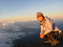
The sky streaked with red and yellow, a sign the sun was about to rise. Although tired, I pushed hard to beat the sun to the summit. I am crawling up the volcano instead of trekking up. When I stepped onto the summit, I realized that it's a large flat ground. Wind is extremely strong. The strong wind moves the sand high into the air. I can hardly open my eyes. I saw our porters lay down and prayed. After the pray, the guide and porters came to shake hands with us and congrats each of us to have reach summit. The entire climb took us 4 hours. It was very cold at summit. The temperature is 3 degree Celsius with strong wind. We descended once the sun started to fill up the sky. I think we stayed less than half an hour at summit. We didn't really admire the scenery and enjoy the sunrise because the chill at summit is unbearable. The way down is easier, sliding down like skiing. While easier, a great deal of stress is put on the knees.

We back to Kalimati campsite around 8am-8.30am. After breakfast, we packed our things and leaving to Ranupani village.

5 July 2008 - Lava View Lodge - Mt Pananjakan - Mt Bromo
We arrived late at Lava View Lodge yesterday. Early morning before sunrise, we were on the 4 wheel drive again to Mt Pananjakan. Although it's a mountain, no trekking is required as the view point is only 10 minutes walk from the place that 4WD dropped us. Once went down from the car, we were surrounded by the people that trying to sell the warm hat, scarf or renting the jacket. The temperature is about 11 degree Celsius. This place is crowded with tourist because of its easy accessibility. Besides, the scenery it offered also made this place a famous view point. Just look at the photo above, don't you feel that it's as beautiful as drawings?

After Mt. Pananjakan, we went to Mt. Bromo to see the crater. There is a short distance from the dropping place of 4WD to the mountain foot of Bromo. Tourist can choose to ride on the horse to the mountain foot instead of walking. I don't know how much it cost because we choose to walk rather than ride on the horse. I never been to desert before but I had a feeling that I was in the desert. I covered my face with cloth, but still cannot prevent the dust and the sand went into my eyes. We climbed up the staircase to visit the crater of Mt. Bromo. The smell of the sulphur is very strong. After took some pictures, I quickly went down from Mt Bromo to run away from the smell.

We were then back to Lava View Lodge. After breakfast, we packed our things and proceed to our next destination - Ijen, which is 6 hours away from Mt Bromo. We spent the night at Catimor Homestay - a lodge that located far inside the coffee plantation.

6 July 2008 - Kawah Ijen
Early morning 6am, we checked out the lodge and heading to Mt Ijen. Around 7am, we were trekking on the trail to the crater. There is a lake at the crater. The sulfur is mined at the lake's edge, which had made the lake become the acid lake. The porters carrying the sulphur (in the form of yellow colored rock) to the top of the crater and then down the mountain. They were paid by weight. According to our guide, the porter can carry up to 100kg for each trip. Unfortunately the weather is not so good, very cloudy. We were not able to see the clear view of the lake and the crater.

7 July 2008 - Surabaya - KL
We spent one night at Surabaya before back to Malaysia.

Trip Expenses:
Flight by Airasia = MYR 282
5D4N package with Global Adventure Indonesia = USD 225 ( MYR 738)
Airport Tax = IDR 150000 (MYR 54)
1 night accomodation at Surabaya = IDR 87000 (MYR 32)
Taxi from Surabaya to airport = IDR 150000 / 9 => MYR 6
Miscellaneous = IDR 181000 (MYR 60)
Total = MYR 1171

Monday, June 02, 2008

Macau (5-8 April 08)

Flight: By Airasia, RM367 per person. Arrive Macau at 7.20pm.

Accomodation: Macau Masters Hotel.
My mother, my sister and I stayed in a standard twin room (without breakfast), cost us HKD 1680 for 3 nights.
Rate for Saturday = HKD 680
Rate for Sunday-Monday = HKD 500 per night
The room is attached with bathroom, small and clean. But there is some smell inside the room, maybe is the smell of the old carpet.
The location of the hotel is quite strategic. Within walking distance to Senate Square. There is a bus stop just in front of the hotel.

Food: We had tried 黄枝记粥面 , 义顺炖奶, 三元粥 and the egg tart. The egg tart is very good. Other food, somehow I didn't felt it's nice.

Transportation: Our legs :p In fact, we really walked a lot. From hotel to Senate Square, Monte Fort, Casino Lisbon and Macau Towers. Bus services are convenient. The bus no and the route is clearly stated at each bus stop. The bus fare is fix - MOP 2.50 per trip.

Visited Places: San Ma Lo,手信街 , Largo do Senado, Monte Fort, Casa Garden, Casino Lisbon, Macau Towers, A-Ma temple, Grand Prix Museum, Wine Museum, the statue of Guan Yin at 新口岸 and The Venetian.

The Venetian is a resort with casino, hotel and also shopping complex. We took the complimentary shutter bus from Sands Macau to The Venetian. The canal, the gondola with the singing gondolier, the European style building and the ceiling that looks like the real sky had made it one of place that you can't miss when you visit Macau.

Saturday, May 10, 2008

KL International Marathon (30 March 08)

I think about 12 of us (10km and 21km running kaki) were registered for the KLIM this year. But on the event day, only 6 persons are shown up. Most of them absent because of the QingMing festival where their family had chosen that Sunday to clean the grave sites of the ancestors. As usual, I took part in the 1okm fun run. I took about 72 minutes to complete the run, 131th in the 10km women category. Well, my result is not good but women category is less competitive. So, I still able to get the finisher medal although I reached after Ah Chak(right most guy). Ah Chak said he's the 508th finisher in the men category. Too bad, organizer only offered 500 medal for each category. If I am not mistaken, Foong Kiew(the girl that wear blue singlet) is the 62th. Lai(the short hair girl) is the only 21km runner in our group. She completed the run in 2 hours 20 minutes.

Gunung Ledang (22-23 March 08)

Nearly 30 persons turn up to the Gunung Ledang day trip. This is my first time to Gunung Ledang. From north-south highway, we exit at Tangkak toll, moving towards Sagil and finally turned into the oil palm plantation from Pintu B. Gunung Ledang resort is about 6km inside the oil palm plantation. We stayed one night at the jungle hut and started the hike the next morning. The weather was good in the morning. However, heavy rain started to pour after 3 hours hike. Our guide doesn't allow us to continue the hike in rain. We had no choice but to descend. I didn't make it to summit this time. Nevermind, I will go again next time. :)

Wednesday, March 12, 2008

Mt Ulu Sepat (9th - 12th Feb 2008)

Mt. Ulu Sepat is a familiar name among the hikers because it falls into the G7 category. G7 is the seven highest mountains in Peninsular Malaysia. Here's are the list of G7 mountain:
1. Gunung Tahan (2187m)
2. Gunung Korbu (2183m)
3. Gunung Yong Belar (2181m)
4. Gunung Gayong (2173m)
5. Gunung Chamah(2171m)
6. Gunung Yong Yap(2169m)
7. Gunung Ulu Sepat (2161m)

Mt. Ulu Sepat is in the remote area of Gerik, Perak. To get there, we have to take the boat from Temenggor Lake. The boat service from Temenggor Lake is not operated in frequent intervals. Although Hai Poh had contacted the boat man before we came, we still have to wait for 1 hour at the jetty. The boat ride took about 1 hour 20 minutes. The boat fare was very expensive. We hired 2 boats, cost us RM500 for one way.
That day, Temenggor Lake was very calm. But exposing under the hot sun at 12 o'clock in the afternoon wasn't a pleasant experience. I applied sun block, wear long sleeves and cap to protect myself from sun burnt. Well, if you think I am too much, then look at the guys of the photo on left. ;)
We reached the dropped off point about 1.30pm. Kampung Lela is the furthest aboriginal settlement from where we got down from the boat . It was another half an hour journey on 4-wheel ride to Kampung Lela. We hired 2 guides for our trip, the guide fee is RM100 per person each day. So, the 3 days 2 night trip cost us RM600. It was already 3pm when we finally started our trek to Mt. Ulu Sepat. By 5pm, we reached the campsite for overnight. The campsite is just beside the river, spacious and convenient. Ah Meng is our cook this time. Guess what? We had "擂茶" as our dinner. Then, the next morning, salad was our breakfast. Very healthy meal :)
Next morning, we reached an open area after 2 hours hike from the base camp. There are a few "houses" which built by the Orang Asli. "Houses" that I mentioned is only the simple shelter that built from atap leaves. On our way up to summit, we met two malays group that went down from the peak. They crossed to Mt. Ulu Sepat from Mt. Chamah. Once of the lady was asking us : "It's Chinese New Year, why are u guys here?". We just smile, didn't answer. Probably all of us didn't really have a good answer. This was my 3rd time hiking during Chinese New Year. I think it's also not the 1st time for other members. Well, I think if you like an activity, you will go for it naturally without any reason. By 5.20pm, we reached the summit.

The temperature at summit is dropped dramatically. While we were still preparing the dinner, the temperature was already dropped till 12 degree celcius. Most of us didn't bring sufficient warm clothing. I couldn't stand the coldness, so I just stayed inside the tent before dinner. The temperature then dropped to 8 degree celcius. After dinner, we opened up a wain and a sparkling juice for celebration, stayed outside until 10pm to watch the stars. That night, I couldn't sleep well because of coldness. I kept on rolling left, then right and waiting for sun to rise.

11th of Feb, we descended from the summit and stayed overnight at the aboriginal settlement. That night, I saw a meteor. This was my 1st time seeing the meteor. :D

The next day, we packed our things and wait for the 4-wheel to pick us up. We wait there for an hour, then our guide came to us and told us that the 4-wheel driver said we are paying him too little. He asked for the higher paid. We were angry that he didn't mention it earlier and let us wait there for 1 hour. We refuse to pay and decided to walk to the jetty instead of riding the 4-wheel. I couldn't remember how long we walk, but in less than 2 hours time, we reached jetty. Once again, we took the boat, crossed Temenggor Lake and back to Gerik. That's the end of our 2008 Chinese New Year hiking trip.

Monday, February 18, 2008

Mt Yellow (23-24th Dec 2007)

Everyone knows about the Mt. Yellow in China, but do you know that there is also an Mt Yellow in Malaysia? It's a mountain that crosses the border of Perak and Pahang. There are two routes to Mt Yellow summit. First is via the Mt Irau and then cross to Mt Yellow, second is start from the Perak-Pahang border at Cameron Highland - Gua Musang highway. 2 years ago, we attempted to trek via first route but we encountered the bad weather which turned out to Mt Brinchang - Mt Irau day trip. We learned the lesson and decided to trek via 2nd route this time. In fact, it's also the raining season but the weather is extremely good throughout our 2 days 1 night trip at Mt. Yellow. On the afternoon after we came down from mountain, heavy rain started. I guess everyone is having the same thought "we were very lucky this time".

The itinerary was not much different from our previous trip. We drove to Cameron Highlands (2 cars from JB and 1 car from KL) , stayed one night at Tanah Rata. The next morning, we met the 4 wheel driver and fetched us to the starting point of the trek by 9.30am. The marker of the state border (left photo) is our "signboard". There is a number on every marker. No. 341 marker is at the summit. I can't remember which number we started, maybe it's No. 562 (friends, correct me if I am wrong), slowly trek up and reached the peak at 2.20pm. We arrived 2 hours earlier than as expected. The weather is hot. We hide under the shade and waiting for the sunset. It's quite boring. That's the problem of arriving too early. :p

As usual, we started to prepare the dinner around 5.00pm. After dinner, we played cards, chit chat and went to bed around 10pm. The next morning, Hai Poh was the first to wake up (well, he's always the earliest, nobody will or want to beat his record). The photo on right shown the morning scene. After breakfast, we packed our thing and left the summit by 10am.

Our 4 wheel driver (sorry, I can't remember the name of that uncle) was already there when we came out from mountain. He invited us to visit his tomato farm. Well, why not? So, we ended up eating fresh tomato in his farm. :D We spent another night at Brinchang, celebrating the cold Christmas eve (not white Christmas :p) in Cameron Highland.

Wednesday, December 26, 2007

Mt. Kutu (15-16th Dec 07)


Gunung Kutu is located at Kuala Kubu Bahru. After passing the dam, following the signboard of Kg. Pertak, turn right after crossing the bridge, we reached the modern aboriginal settlement at 3.30pm. This is the starting point of the trekking. The first 1/2 hours was walking on the wide jungle path which can be easily accessible by the 4 wheel drive. After crossing the bridge for 2 times, I remembered we still have to cross river (which doesn't have bridge) for 2 times. Then, the real journey began. We met one large group of high school students after an hour. They told us that the fallen bamboo blocked the way and they couldn't proceed. So, they decided to descend. Man Tack and Kok Yuen are experience hiker. So, they proceed and found out we can still proceed by taking the small path beside the blocked way.
The fallen bamboo kept on blocking the way. We lower down the body or sometimes have to remove the bagpack and crawl like the snake in order to pass through. By 5pm, we came to a rest point. It's a place which sheltered by the large piece of rock. We rested there for almost half and hour.
The longer we rest, the more lazy we are. So, we have to move on in order to reach summit before night fall. I remembered I kept on asking Ah Tack " how far we are from summit" ? Then, he will answer "Very near". Finally, we reached there an hour later. It took us 3.5 hours trekking from the mountain foot until the peak. I was fascinated by the unique of Mt. Kutu summit. There is a chimney, ruined staircase and base pillars there. It seems like there was a castle or bungalow there long long time ago. The most incredible is there are two wells at the peak - one is dry and one is with water. It's a nicely built well. I do not know any history of this mountain, so not able to tell why there is a water well and ruined bungalow structure up there.
Sunday morning, while waiting for Kok Yuen to cook the porridge, Ah Tack brought us to the highest point of Mt. Kutu - a big rock that stands at the summit. It's just 3 minutes walk from the campsite. With the help of Ah Tack, I managed to climb up to that big rock. The 360 degree view from the top is very beautiful. Actually, it's quite dangerous to stand up at the big rock, especially when the wind is strong. The scenery at the top of Gunung Kutu is definitely worth the hike. It's the raining season. But we were lucky as the weather is quite good throughout our trip.
Kok Yuen can't wait to join us at the top of the mountain. So, he left the porridge that still being cooked and climbed up to find us. We enjoyed the scene, the air, the view and the moment until we forgot about the porridge. As a result, we have to eat the burnt porridge as the breakfast. :p

Tuesday, November 13, 2007

Northern Vietnam (5th Sep-18th Sep 07) Part 3

13th Sep 07 – Lao Chai and Ta Van Village
A visit to the Hmong village in Lao Chai and Ta Van was our last itinerary in Sapa. We transferred by minibus to from Sapa town to Lao Chai. Once we got down from the minibus, the Hmong women and children approached us to sell the walking sticks, handmade bag etc. We ignored them and trekked down to the valley. But they were not easily gave up, followed us for quite a long journey and bug us with the phrase “You buy from me?” .

We trekked through the rice terraces. The landscape is quite impressive. We visited the primary school and having lunch at one of the Homestay in Ta Van. Besides Hmong, we also met other hill tribe in Ta Van, eg: Red Dzao. I will recommend those that interested to visit Sapa to trek at Lao Chai and Ta Van village. The trekking took us about 4 hours including the lunch time. But the scenery it offered is definitely worth the visit. The trip ended around 3pm. We took the train from Lao Cai back to Hanoi at night.

14th-16th Sep 07 – Halong Bay – Cat Ba Island – Hanoi
The train reached Hanoi at 5am. We took the taxi from train station to the agent office. The office is not yet opened. We took our breakfast at the stall beside the road, and then sat beside the road from 6am – 9am, watching streets from quiet become very busy. 套用海波的一句话- 我们看着河内渐渐苏醒.

We board the minibus to Halong bay at 9am. Halong bay is a UNESCO World Heritage site which consists of around 2000 islands. Halong bay has become a “must go” destination for tourist that visited Hanoi. We get on the boat and enjoyed the cruise. In the afternoon, we visited the Sung Sot Cave – the largest cave in Halong bay. Then, we stopped at one of the island for swimming. I did not swim but trekked up to the island to get the view from the top. We stayed overnight at the boat.

The next day, we pack our things and move to a smaller boat that will take us to Cat Ba Island. On the way to Cat Ba island, we stopped for kayaking. Halong bay is very suitable for kayaking. We didn’t feel it’s in the ocean because the water is very calm. I didn’t know how to kayak but luckily I have Lai as my partner. She loves kayaking. So, due to my laziness, she did the kayaking most of the time. I am just resting and enjoying the scenery. :p

We reached Cat Ba island at noon. After lunch, we went for a short, relaxing hiking trip and visited a cave in the island. After the trip ended, we rented the bicycle to explore the island. We went to the beach, the pier and red light district of the island. I enjoyed the day very much.

We left Cat Ba and Halong bay the next day. Accommodation is the first thing that we need to settle once we back to Hanoi. A young man approached us, gave us a hotel brochure and offered the room at his hotel for USD 5 per person. So, Tack, Liow, Karen, Lai and I followed that young man to check out his hotel. The hotel is located inside the small street, different from the brochure stated. Then we found out what he offered is different from our expectation. He only gave us 2 double rooms and 1 triple room for 10 persons. We spent a lot of time to bargain with him. Just before we would like to give up and find other hotel, he agreed to give us 5 double rooms includes breakfast with USD 5 per person.

At night, we went to watch the water puppet show. I think all of us doze off during the show. Well…..what I can remember about the show is some puppets moving in the water, with the Vietnamese traditional music as background. I don’t know what the story is behind and slept most of the time. For anyone of you that would like to visit Hanoi, I will advise don’t waste the money to watch the water puppet show unless you really know how to appreciate the art.


17th Sep 07 – Perfume Pagoda
Perfume pagoda is located 70km from Hanoi. We walked in a tour agency and booked a private tour for perfume pagoda day trip. The package costs USD 11 per person which include the transport, guide, entrance fee and lunch. Perfume pagoda is not only one temple but a cluster of temples located on the limestone rock of Huong Son Mountain. We were surprised by the golden-yellow paddy fields along the way. It’s the harvest season. The villagers stacked the harvested paddy beside the road. They still use the traditional way to harvest the paddy.

About 11.30am, we reached a small village where we have to sit into a boat and row by the locals to the perfume pagoda. The weather is not too hot, which made the boat journey very nice. After about 1 hour and 15 minutes boat ride, we were told to get down from the boat. There is cable car service to take the tourist to visit the pagodas uphill. But we decided to trek up instead of sitting in the cable car. We visited few pagodas on our way up. It took us about 1 hour to reach the highest pagoda. To our surprise, we met Yeap – one of our hiking friends at the highest pagoda. He was traveled with his family. I knew that he is traveling to Vietnam but it’s such a co-incidence to see him there.

We didn’t spend much time there and decided to trek down to have our lunch. After lunch, we visited the Thien Chu pagoda before took the boat back to the village. The perfume pagoda is not special but the journey is remarkable. The boat ride and the golden paddy fields had made the trip memorable.

September is the raining season but I never expect to experience the flood at Hanoi at the last night of my trip. Rains started to pour when we walked back to hotel after dinner. The rain was getting heavy. Ah Ming, Tuck Seng, Liow and I were having bia-hoi at the street, seeing the water rise up to the knee level within an hour time. We wait until the rain was getting smaller, then wade through the water along the flooded street to go back to our hotel.

18th Sep 07 – Back to Malaysia
Tuck Seng and Foong Kiew took the morning flight back to Malaysia. The rest of us took the night flight. So, we have more than half a day to go for shopping. We went to Dong Xuan market. Dong Xuan market is mainly for the wholesalers to get their supply. So, not all of the shops will entertain us as they only sell to wholesalers. We had quite a bad experience of shopping in Hanoi. The sellers are not friendly and scold us when we did not buy from them after take a look. Actually I had a bad impression of the Vietnamese attitude. From the 2nd day until the last day of the trip, we had encountered quite a number of rude treatments from the hotel staff, tour guide, post office staff and the sellers. I don’t like Hanoi and also don’t have the intention to visit it again.

However, the trip is still full of laughter, especially the drama between Hai Poh and Karen which had given us lots of fun. I appreciate the travel moments with you all. Hope all of you enjoyed it as well. ;)

Tuesday, November 06, 2007

Northern Vietnam (5th Sep - 18th Sep 07) Part 2

10th-12th Sep 07 – Mt. Fansipan

Mt. Fansipan is the highest mountain in Indochina, at 3143m. It’s the main focus of our trip. The minibus brought us from Sapa towards Silver waterfall and stopped at the starting point of the climb. Just before we started the climb, it rains. It was very misty, visibility was low. We were not able to see the beautiful view of forest. We felt disappointed and prayed that the weather will be good for the next day.

Our package includes porter service. But the porters only carried our food, not our backpack. We had trekked for 6 hours before reached the campsite. A simple bamboo hut was built at the campsite for hikers. As we were the only group there, we occupied the whole bamboo hut. It’s still raining out there. But surprisingly it wasn’t very cold. The dinner was prepared by porters. After dinner, we played cards until the guide urging us to bed.

11th Sep 5.30am, we took our breakfast, carried the light backpack, put on our headlight and started to hike up to summit. The weather was bad, still raining and misty. The trek was muddy. After 4.5 hours trekking, we climbed up a vertical wall (straight up at an almost 90-degree angle) using rope. All of us were excited because we thought summit should be within 5-10 minutes journey after climbed up the wall. But apparently we were wrong. After half an hour hiking, summit is still not in sight. The trail seems like endless. Initially, Lai, Ming, Tack, Karen and I were together. But after a while, Lai, Ming and Tack were disappeared. They were too fast, I couldn’t cope with their pace. Karen and I were exhausted but kept on pushing ourselves to move forward. Finally, I had reached the summit at about 10.50am, took me 5.5 hours from the campsite. 9 of us had arrived at the top. The weather was not good, very cloudy. We really regret to have not seen the spectacular view across the peak of Mt. Fansipan. While waiting for Tuck Seng and Liow to arrive, I recorded a video at the summit. My friends, still remember what did you say?

Tack : 这么容易的山,下次不要叫我来爬。没有比我想象的冷。
Lai : 我觉得不容易 lor, 看我的脚。(point at her muddy leg)
Hai Poh: 我们蠢事做尽,终于上来了。因为我们有罪。
Karen: 终于给我过关了。
Ming: 很高兴,可以和他们一起来爬山。
Soo Ching: 来,我拿国旗。越南国旗, Mt. Fansipan, yeah!
Joshua: 我要感谢国家,感谢上帝。
Ah Kiew: 我希望快点吹走那些云,爬得那么辛苦,坐飞机来到这里。
Jing Yee: 好辛苦啊。刚才爬的时候一直不到顶的,终于到了。

At last, Liow and Tuck Seng had arrived. We welcome them by singing the songs. http://travel.webshots.com/video/3099187230066465503bHhjXZ

The journey wasn’t ended as we still have to trek back to the campsite. We started to descent at 12.30pm and back to campsite at 5pm.
12th Sep 9am, we descended after having breakfast. We chose to descend to Sin Chai village instead of following the original route. Although the Sin Chai village route is longer, I think we had made the right choice because the scenery there was very beautiful. Sin Chai village is isolated and seldom visited by tourist compare to the commercialized Cat Cat village. Our Mt. Fansipan hiking trip was ended at Sin Chai village.