Wednesday, August 08, 2007

Putrajaya Treasure Hunt (29 July 07)

The group of friends that I knew during Penang Bridge Run was looking for people to participate in the Putrajaya treasure hunt. I decided to join them since I never participate in the treasure hunt event before. Eventually, 2 teams are signed up. Each team consists of 4 persons. Ding, Yan Nee, Wei Chun and I are in the same team. Ding is the driver, Wei Chun is map reader and navigator, Yan Nee and I are communicator. Hui Meia, Chak, Keen Yee and Sew Yong are another team. Hui Meia is the driver, Chak is the navigator, Keen Yee and Sew Yong are communicator. Each of us plays an important role in the hunt. Team work is always very important. :D

A day before the actual event, we went to Putrajaya to collect the goodies bag and attend the briefing. Each participant is given a goodies bag with a t-shirt, participant tag, cap, a pen and tourism Malaysia booklet. Each team is given RM20 petrol voucher and required to buy a Putrajaya map with RM5. In open category, there are 100 cars participated. For closed category, there are more than 100 cars. In the briefing, we had been informed that the treasure hunt consists of 2 parts. First part, we have to drive to the location given according to co-ordinate and perform the task. 2nd part, we have to answer the treasure hunt questions and buy the treasures. We had been warned that handphone, camera, PDA, dictionary are all not allowed in part 1. The team will be disqualified if caught by marshals. After briefing, we drove around to get familiar with the places in Putrajaya.

Sunday 5.45am, Ding, Chak, Yan Nee, Keen Yee and I are in front of Keen Yee’s house, tried to put the stickers of sponsors on Ding’s car. The car needs to be ready with the stickers before queuing up for the flag off. Suddenly, rain started to pour. We quickly put all the stickers on and proceed our way to Putrajaya. One of the sticker flew away on the way. The car emergency break, then Chak went down to collect back the sticker. Luckily it’s very early in the morning, there is no car there except us. We arrived about 6.20am, lined up at the end of first row. There are about 20 cars in each row. Free breakfast (coffee and cereal with milk) is served. As rain was still pouring, we stayed under the tents while waiting for the event to start. Hui Meia and others came afterwards and line up almost at the end of second row.

7.30am, we had another short briefing. Then 8am, the organizer started to flag off the cars. All of us are very excited. In the first part of treasure hunt, we will need to go to 5 locations (A-E) and perform the task. Location A-C are opened at the same time. So, hunters can choose to go to which location first. We find out the location according to co-ordinate given, and then choose to go location A first which is Equestrian Park. At Equestrian park, 10 pictures of the interesting places in Malaysia are displayed. We are required to write down the state it located.

After complete the task, we get the chop from the organizer and proceed to location C – Taman Wawasan. At here, pictures of Malaysia’s Prime Ministers are shown. The task is to write down from which year to which year they become the Prime Minister of Malaysia. We are all not good in history, even cannot recognize correctly which person is Tunku Abdul Razak and Tun Hussein Onn. :p

After that, we went to location B (Laman Duta) and the task is to match the National day logo from 1998 – 2007 with it’s theme. After we got the chop from location A-C, we need to go location D – Yayasan Kepimpinan Perdana. This place cannot be found in the map. So, we spent quite sometime to drive around, checked the signboard and finally found the place. At here, we are given a set of questions about our country history. Luckily all answers can be found in this place. At last, we checked in at location E - Taman Pancarona. The final task of part 1 is to re-arrange the characters given and list down the name of the ministers. 10 groups of characters are given. We spent around 1 hour there. Wei Chun is very good at this task. The most incredible thing is we simply put a name for a question that we are not able to get answer and we got it right!! I guess I will not forget who our tourism minister is now. Hahaha…. Generally, I think we did quite well in this part 1. Strategy and teamwork is very important in this part 1. Ehem……friends, you knew what I mean. ;)

The part 2 of the treasure hunt started at 1pm at Alamanda, Putrajaya. We are required to answer the questions, buy the treasures according to the clue. Teams have to submit their answer sheets and hand in the treasures they bought by 2.30pm. 15 minutes penalty time will be given. 1 point will be minus for every 5 minutes after 2.30pm. We have no problem to identify the treasures but those treasure hunt questions really give us the difficult time. For regular hunters, they know the technique to interpret and answer these questions. They also know how to find the answers from the clue given. We tried our best to answer all questions. It’s almost like the examination, if really clueless, just simply put in one of the shop name as answer. Other participants will also cover their answer sheets, wouldn’t share any of the information or probably give wrong information to other teams. It’s almost 2.30pm, we all quickly filled in all the answers and rushed to submit the answer sheets and handed over the treasures. No penalty for us. The treasure hunt was ended. We all went back for rest and came back at night for the dinner and prize giving ceremony.

The dinner started at 8.30pm. I believe the top 20 teams that won the cash prizes are all regular hunters. The organizer then gave us the answers of all the treasure hunt questions. Eg:
1. Question : Jails.
Answer: NewsNow.
Explanation: Jails can be re-arranged become “Salji”. In Malay, “Salji” means Snow. There is word snow inside “NewsNow”.

2. Question : Dalam gazebo ni ada apa yang dicari.
Answer : Bonia.
Explanation : « gazebo ni ada »

3. Question : Gambar kemerdekaan sebahagian sahaja kelihatan.
Answer : Fotokem
Explanation : Gambar => Foto , take part of the « kemerdekaan » => kem , so become FOTOKEM

4. Question: Small testimony regarding money?
Answer: mini statement @ CIMB bank ATM
Explanation: Small can be interpreted to mini; testimony can be interpreted to statement. ATM machine is something about money. At the screen of CIMB ATM machine, there is an option call mini statement. So, combine all the clues, answer is mini statement @ CIMB ATM


We really couldn’t figure out those tricky questions. Anyway, we still can answer some of the questions correctly. Eg:

a) Question: Kacukan durian Perak
Answer: Guardian
Explanation: We tried to find the word “durian” in any of the shop name. So, we found durian in "Guardian" .

b) Question: Jalan untuk menjadi jutawan?
Answer: First Millionaire Avenue Money Changer
Explanation: Jutawan => Millionaire, Jalan => Avenue

c) Question: 1st head master transformed
Answer: Hamster London
Explanation: 1st head => H , combine with the re-arrangement of the word “master” becomes “Hamster”. There is a shop call Hamster London.

d) Question: Old speed indicator related to the boycott of Harry Porter
Answer: MPH Bookstores
Explanation: Old speed indicator => MPH. There are Harry Porter books at the display window of MPH Bookstores.


The dinner and ceremony ended around 10.30pm. Although we didn’t win any prizes, we did enjoy this event very much. We had a lot of fun and it’s definitely a wonderful experience for us.

Friday, August 03, 2007

Bali (7 July - 10 July 2007)

Day 1 (Kuta)
I took 4.40pm AirAsia flight together with Huay Mein, YCK, YCK’s sister (Karen) and Kok Yuen to Bali. We arrived at Bali 7.40pm as scheduled. We walked out from the airport and there was a taxi driver approached us. He offered Rp 200,000 to take us to Kuta. The price sounds ridiculous for us. Then, another taxi driver came by and finally we agreed to take his taxi with Rp 80,000. We knew that it’s still very expensive but to save the hassle of finding another taxi driver, we just took his offer.
At Kuta, the taxi driver refused to go into Poppies II Road with the excuse of traffic jam. He dropped us at one of the main road and told us to walk into Poppies II road. At first, we had problem to locate the road. We walked into a small dark street where a lot of dogs barked at us. But luckily after asking around, we had finally reached the guesthouse – AP Inn and checked in. At night, we met up with Ying and Jane who took the morning flight to Bali.

Expenses for the day:
KLIA Transit (Putrajaya – KLIA) : RM 6.20
Bus (KLIA – LCCT) : RM 1.50
Taxi from airport to Kuta : Rp 80000 / 5 persons = Rp 16000
Dinner : Rp 20,000
Room (with breakfast) at AP Inn : Rp 175,000 / 3 persons = Rp 58,333


Day 2 (Kintamani - Ubud)
We chartered a van to take us for Ubud and Kintamani tour. We paid Rp 400,000 for 8 hours service which includes van, driver, guide, petrol and soft drink provided during the trip. Batubulan is our first destination. This place is known for Barong dance. The dance is 2 hours and cost Rp 50,000 per person. There is a group of musicians play the traditional instruments for the dance. The storyline of the dance is about the battle of the good and evil force where Barong (sacred lion) represents good force. I am not the artistic person. So my personal opinion for the dance is boring, boring and boring.
On our way to Kintamani, we stopped by Tegalalang to see the rice terrace. Then, we proceed our way to Kintamani – a place that offers nice view of Gunung Batur and Lake Batur. We were having our buffet lunch at one of the restaurant that overlooking Gunung Batur. The food is not nice and expensive. Basically we paid for the scenery rather than the food. After lunch, the guide brought us to a place for free coffee. It’s in an orchard and there is a shop there to sell coffee, lemon tea, aroma therapy set etc. We stayed there for about an hour before we moved to the next destination. We didn’t visit the temple at TampakSiring because it was closed for ceremony. The last attraction that we went was Pura Goa Gajah. We need to wear the sarung to enter the temple. No additional charges for the sarung as it’s included in the entrance fee.

It about 6pm after visited Pura Goa Gajah. We went to Ubud to look for the hotel. A guy that was playing badminton beside the road beckons us. We followed him into a small garden to check out the rooms. We like the rooms and it’s definitely value for money. Fan room with attached bathroom, triple sharing and breakfast included only cost Rp 90,000. The room is very clean and the environment is nice. So, we finally settled at Merthayasa Bungalows at Monkey Forest Road for the night.

Expenses for the day:
Transport (van) : Rp 400,000 / 7 = Rp 57,142
Lunch (Kintamani) : Rp 72,600
Entrance Fee of Kintamani : Rp 2,000
Entrance Fee of Pura Goa Gajah : Rp 6,000
Room (with breakfast) : Rp 90,000 / 3 = Rp 30,000
Dinner : Rp 26,400

Day 3 (Ubud - Tanah Lot – Mt Agung)
Huay Mein, Karen and I woke up very early in the morning and walked to the Ubud market. It took us about 20 minutes to reach the market. A lot of things can be found in Ubud market, eg: wood craft, souvenirs, clothing, handbags etc. We didn’t have much time to shop as the van that will pick up Huay Mein and others for day tour will arrive at hotel by 10.30am. We shop until 10.20am and ran back to the hotel. Then, Huay Mein, Karen, YCK, Ying and Jane checked out the hotel at Ubud and went for Bedugul, Taman Ayun Mengwi and Tanah Lot day tour . They will overnight at Kuta afterwards. Kok Yuen and I stayed at Ubud until the night because of Mt. Agung climbing. We arranged the climbing with the agent in Ubud.

Ubud is a nice place. It is quiet and relaxing. Kok Yuen and I went to the Dirty Duck Restaurant to have our lunch. This restaurant is recommended by my colleague - Shiao Peng. We walked into the restaurant and immediately impressed with it. Paddy fields are behind of the restaurant, or shall I say the restaurant is actually built at the paddy fields. It’s really nice to have lunch beside the paddy fields. Besides, the food there is good and the price is reasonable for the portion of food that they served.

After lunch, we hired a car to Tanah Lot. Tanah Lot is the main tourist attraction of Bali. I was fascinated with the coast, the rock formation and the temple that built on the rock. Tanah Lot is the famous spot for sunset. I visited Tanah Lot in the afternoon around 3.30pm. So, the tourists are lesser. We went back to Ubud after an hour and arrived at 6pm. Then, I went for the spa. Almost all the shops at Ubud were closed when I came out from spa. Kok Yuen and I just picked one of the restaurants that not far away from hotel to have our dinner. Then back to hotel to pack our things. At 10.00pm, we took off to Besakih.

It took us about 1 hour to reach Besakih. Besakih is about 1000m above the sea level. I felt cold once I got down from the car. So, I immediately put on my jacket. We met our guide – Getir, which I guess is about 21-25 years old. He checked and made sure that we brought sufficient water and food. We started the journey around 11.30pm.

Expenses for the day:
Transport to Tanah Lot from Ubud: Rp 200,000
Lunch : Rp 101,000
Dinner: Rp 51,750
Room: Rp 35,000
Entrance Fee of Tanah Lot: Rp 125,000
Spa : Rp 125,000
Miscellaneous: Rp112,000
Mt. Agung hiking package : Rp 450,000

Day 4 (Mt Agung - Kuta)
There are 2 starting points for Mt. Agung hiking, from Pura Pasar Agung or from Besakih. The route from Pura Pasar Agung is shorter but doesn’t go to the actual peak and only offers 180 degree view from the top. We chose the longer trail from Besakih which will go up to the summit that offers 360 degree view.

We climbed the stairs, towards Besakih temple and then slowly by passed Besakih temple. Soon, we saw two guys together with their guide climbed up the stairs. The guys are from UK, one of them speak very good Indonesian language. We were the only 2 groups that climbed Mt Agung from Besakih that day. We reached Pura Pengubengan about 35 minutes later. Our guide did his prayer at this Pura before continue to hike up. He told us that every guide that climbs Mt Agung will pray here for the safety and smoothness of the trip.

The night was cold. The dark sky was full of stars. The night scene of Bali was beautiful and quiet. On the way up, we stopped quite often for 2-5 minutes to rest and enjoyed the night scene. We switched off the light from our headlamp. The darkness had made the stars brighter and lights at far clearer. Our guide pointed to us which pool of lights is Besakih and where Kintamani is located. The trail was steep all the way up. The temperature was getting lower when we went higher. It was about 10 degree Celsius when we left the forest trail and started to hike on the rock. I couldn’t stop for more than 5 minutes, had to walk continuously to keep my body warm.

Mt. Agung is a volcano. I heard that the last eruption was at year 1963. This was my first time trekking up a volcano. It’s very different from the mountains that I trekked before. I need to be very careful when trekked on the terrain with steep passage on loose and rocky ground.

It’s 4.30pm. We had trekked for 5 hours. The guide told us that we were 1 hour away from the summit. He asked us to stop for half an hour. The reason is sunrise will be at 6am, we can’t stand the wind and the cold at the summit if we arrive too early. Our guide made the fire for us. 6 of us – Kok Yuen, 2 UK guys, 2 guides and I stayed close to the fire. I felt very sleepy and nearly fall asleep. I don’t know is it because of trekking through the night or the thin air. It’s 5.00 am. We continue our journey to the Mt Agung peak.

20 minutes to 6am, the sky on east had started to change color. We seem so close to the peak. I was excited and had moved faster. But when I climbed up the top that seem like peak, I found out that there is still another slope in front. So, I continue the climb. After I climbed up that slope, there is still another slope in front. I was tired and slow down. The two UK guys bypassed me. Finally, I reached summit. We started at 1000m and the summit stands 3143m from sea level, which mean we had climbed up 2100m in 6 hours time. But the magnificent view that offered by Mt Agung is definitely worth for the hike.


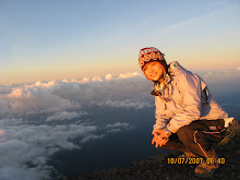
I was standing at the highest point of Bali island. The temperature was low (5 degree Celsius). Looking east, the sun was slowly rising. Mt. Rinjani at Lombok Island looks mysteriously from far. On the east-north part, it’s the splendid sea of clouds. Looking south, it’s the spectacular view of Mt Abang, crater of Mt. Batur and the Lake Batur which lies within the crater. As the sun went higher, it threw the shadow of the Mt Agung to the west. I was very happy and felt lucky that we were able to see this beautiful scenery.

7.30am, we started to descend. It’s a long and dangerous journey. We only stopped for one time for breakfast, and then descended towards Besakih without resting. We took 4 hours to reach Besakih. My knee was extremely painful after the long hours descending. Mt. Agung climbing is only recommended for those with hiking experience as it’s really strenuous to hike at high elevation over the rocky terrain and descend in the same day. I visited Besakih temple before transferred back to Kuta.

I reached Kuta at 3pm, took the late lunch and walked to Kuta Beach. I met Huay Mein, Karen and YCK at Kuta Beach. We went for the final round shopping. Then we went to the airport and took 8.10pm flight back to KL.

Expenses for the day:
Lunch: Rp 50,000
Transport to Airport: Rp 50,000 / 6 = approximately Rp 9,000
Dinner: Rp 23,600
Airport Tax: Rp 100,000

Bus from LCCT to KLIA : RM 1.50
KLIA transit (KLIA - Putrajaya) : RM 6.20
Miscellaneous: Rp 41,000

Total Expenses for the trip: RM 944
Flight : RM 253

Meal: Rp 345,350 /2550 => RM 135.40
Transport: Rp 282,142 /2550 + RM 15.40 => RM 126
Accomodation: Rp 123,333 /2550 => RM48.40
Entrance Fees: Rp 133,000 /2550 => RM 52.20
Mt. Agung hiking: Rp 450,000 /2550 => RM 176.50
Miscellaneous: Rp 164,000/2550 => RM 64.30
Spa: Rp 125,000/2550 => RM 49
Airport Tax: Rp 100,000/2550 => RM 39.20

Monday, July 30, 2007

Penang Bridge Fun Run (24 June 07)

Penang Bridge International Marathon is one of the biggest annual events of Malaysia. This is the only time that the bridge that connects Penang Island and mainland of Peninsular Malaysia will be closed. Imagine that running or even walking on the Penang Bridge that is no car and specifically closed for runners.... it should be fun. So, I decided to participate in the Fun Run category this year. The fun run category is opened for participants of 13 years and above. The distance is 10km and participation cert will be given to runners that finish the distance within 2 hours. This was my first time participated in the run.

I joined Lai and her friends for the trip to Penang on 23rd June. I met some of them before, like Hui Meia, Cheng Mei, Sew Yong and Keen Yee. The world is small. Hui Meia, Keen Yee and I were actually university course mate. Hui Meia was our senior and Keen Yee was from different major. Besides the run, this was also a “makan-makan” trip. 9 of us traveled from KL in 2 cars and reached Ipoh by 9 something in the morning. We went to restaurant Ming Court to have dim sum. After the heavy breakfast, we proceed our way to Penang Island and checked in Anggerik Lodging around 12.45pm. There were a lot of participants stayed there because it’s near to the starting/ending point of the run. We then went to Queensbay mall to collect our t-shirt. In the evening, we walked around the check out the exact place for the registration the next morning.

24 June 07, we woke up at 3.30am and had some light breakfast. All of us walked to RECSAM to register ourselves. RECSAM was crowded with people that we could hardly walk. This place was the registration place for quarter run and fun run. Fun run started at 5.30am. About 8000 persons participated in the fun run. Started from RECSAM, all of us ran towards Penang Bridge. I felt very tired after running slowly for half an hour, so from running, it’s turning to fast walk. After making the u-turn at the mid of Penang Bridge, I stopped for a while and walked slowly. The sky became brighter and brighter. Overlooking Penang Island from the bridge, I slowly run towards the finishing line. It’s tiring but somehow it’s fun. By 6.55am, I had finished the run, feeling excited and exhausted. Sew Yong saw me, took a picture for me and told me to look for others at the Milo booth. Ding, Chak and Keen Yee had finished earlier. Soon, Hui Meia arrived. Lai had also joined in the run even though she hurt his leg during training. All of us managed to finish the 10km distance.

The run was completed. So, we went to “makan-makan” again. We had our lunch at Lorong Selamat which near Komtar. Before we went back to KL, we stopped by Ipoh for the white coffee. The last stop was at Bidor for its famous duck noodle.

Thursday, June 28, 2007

Dark Cave Adventure Tour (17 June 07)

Batu Caves is one of the tourist attractions which located not far away from KL city centre. But most of us only visit the temple cave and didn’t notice the Dark Cave, which the entrance is located at step number 204 of the 272 steps leading to the temple cave. I decided to organize a trip to the dark cave after hearing Lai’s interesting experience. I browsed through some websites and sent the enquiry email. Eventually, I got the reply from Patricia, the marketing manager of Speleotrend Enterprise. They organized the dark tour together with MNS ( Malaysia Nature Society ). 2 types of tours are offered: educational trip and adventure trip. I would like to go for the adventure trip that sounds more exciting.

Next, I will have to get enough persons to join the trip together. The cost of the tour is RM50 per pax with minimum 8 persons. After broadcasting the idea via email, I had finally got 15 persons that signed up for the trip. 3 persons joined at the last minutes, so altogether there are 18 persons in our group. Although I didn’t know all of the participants, it’s always nice to meet new friends. :)


17th June 07, all of us gathered at Batu Cave by 10.30am. Helmet, headlamp and Wellington boots were provided. Jaya was our cave warden. The tour began at 11.30am. We walked at the passageway that leads into the dark cave. I felt clumsy to walk with the boots and could hardly see the way as the light was very dim. Jaya brief us on the history of the dark cave and a little bit knowledge of the formation inside the cave. He warned us not to touch the formation in the cave. This is because the stalactite and stalagmite in the cave took thousands or even million years to form. We have to learn to appreciate and preserve it. Besides, he also demonstrated how we should crawl inside the tiny adventure path later.

We saw a white snake while we were on the way to the adventure tunnel. It lie there didn’t seem want to move. So, we bypassed it quickly. When we reached at an open space, Jaya asked all of us to switch off our headlamp and then closed the eyes. Then, he switched off his light and asked all of us to open the eyes. It’s totally dark!! We couldn’t even see our fingers. The cave warden, Jaya told us that this was the real dark cave environment. All of the creatures inside the cave live in the dark. If we encounter any creature, try not to disturb them as we are only the visitor to the cave.

I couldn’t wait to check out the adventure path that Jaya mentioned earlier. But just before we want to enter into that 1 feet high tunnel, a guy was crawling out from the tunnel. This is another group that also went for the adventure tour, but followed the path in opposite direction. When all of the members of the other group finally out from the tunnel, it’s our turn to get wet and dirty. The floor was wet and muddy. But we had to do the army crawl to get through the tunnel. At some point, the hole is very small. So, we had to turn the head on one side in order to get through. Foong Kiew took the pictures for when we were in the cave. She was the only person that brought camera in because her camera has the underwater casing.

After crawling for a short distance, I reached the part where ceiling is a big high up. We rested there for a while before proceed for the 2nd part crawling. Once we went out from the tunnel, it’s turn for us to climb up the wall and slide down to a pool. Jaya went down first to the pool and helped us when we were sliding down one by one. The water level is above my waist. We waded through the water and climbed up the wall again. Then, we came to an open space – a place where the light came in from the top of the cave. The exit was not far away from this open space. Our adventure tour ended at 2.15pm.

Our clothes were dirty, wet and smelly. So, we paid RM1 to took shower at the bathroom which provided by temple. Then, we took our late lunch at Air Panas, Setapak. The food there is delicious. It’s a nice weekend with exciting trip and nice food.


p/s: I am receiving the feedback from some of the members after the trip. I am really glad that everyone did enjoy themselves. :)

Wednesday, June 13, 2007

Mt Benom

2 years ago, when I was resting at the beautiful valley of Mt. Rajah, Hai Poh told me that there is another mountain which located not far away from Bentong. That was the first time I heard about Mt. Benom – a mountain that very difficult to hike, no view, no scenery and the only thing worth to see is giant nepenthes. Hai Poh even use the word “ugly” to describe it. I never want to hike Mt Benom. However, I still turned up for the trip this time with the mindset of “training for Fansipan”. To my surprise, Mt. Benom is not as bad as I thought. Well, at least it’s better than Mt. Inas.
Two 4WD brought us to the starting point of the trek. Berembun Waterfall is located not far away from the starting point. I had been to the waterfall twice but this time will just focus at Mt. Benom. There are two routes, one is from the waterfall which is longer and we took the other route which bypass the waterfall and directly led us to jungle. The red ginger flowers catch our eyes. This was the 1st surprise that Mt Benom gave me. We took quite sometime to photograph these beautiful flowers before proceed our journey. It’s almost 10.30am when we finally set off for the hike.
15 minutes later, we came to a riverside. After crossing the river, we start to climb up the steep trail. The trek was as difficult as expected but not as wild as I thought. This was the 2nd surprise. The trek is obvious and not much fern blocking the way. Only after 1 hour trekking, Hai Poh stung by bee at his nose. He was allergy to bee sting and his face and legs were swollen immediately. He trekked slowly, took break when he felt dizzy. After a while, his legs started to cramp. Evie, Tack and Peng Meng helped to carry some of his belongings to reduce the load of his backpack. I kept on hearing he mumbled to himself “ 争气一点 ”. Although not feeling well, he still able to proceed the journey.

Lai, Tack, Foong Kiew and I reached the campsite (1761m) at 4.30pm. We were busy posing and taking photos without realize that the weather was changed. Rain started to pour and getting heavily. We quickly set up the tents and stayed inside until the rain stopped. After the rain stopped, Evie and Ren prepared for our dinner. The rest of us are either helped them or just sat and wait for the dinner to get ready.

The next day morning (9.40am), all of us carried the light backpack which loaded with food and water, then set off for the ascent to summit. We have to traverse 32 peaks and valleys before we reach summit and retrace the route back to this campsite on the same day. It’s 64 times ascending and descending altogether!!! It’s tough and challenging for me. We reached the 2nd peak after 1 hour trekking. The view here is nice and the giant pitches can be seen everywhere. We stopped for more than half and hour to take pictures and rest. Ren decided not to continue the ascent. So, he separated from the group and went back to campsite. The rest of us continue the journey in rain. After went through a subtle of ascent and descent, we finally arrived at Mt. Benom peak at 3.30pm.

There is a flat ground at the peak where we can admire the scenery. This is the 3rd surprise. Kok Ming and Hai Poh told us that this flat campsite wasn’t exist 3 years ago. It’s almost an hour later when we started to retrace the route to the campsite. This time, we seldom stop for rest and hoping that we will able to reach before sunset. However, I really very tired and can only trek slowly. By 7.30pm, I had to put on my headlamp and trek in the dark. I walked together with Kok Ming and Evie. At last, we back to the campsite around 8.15pm, feeling exhausted.

The 3rd day, the descent began around 10am. On the steep trail, I slide down instead of trek down. :p The 4WD picked us up at the foot of mountain and drove us back to Sg. Klau. The trip ended with the late lunch at Bentong. Mt. Benom, the 10th highest mountain in Peninsular Malaysia is not the peak that thrills hikers, but somehow she still has special charm and it’s a really good place for training.

p/s: Evie said Mt. Benom is difficult than Mt Fansipan. Hmm….how true is it? I will be able to tell after September. ;)

Monday, May 07, 2007

Mt. Inas (30th April - 1st May 07)

Hai Poh went to Gunung Inas 5 years ago and had described Gunung Inas as the 2nd beauty of Banjaran Bintang. So, 14 of us signed up for the Gunung Inas hiking trip during the Labour day. I went to Gunung Bintang at June 2005 which also located in Banjaran Bintang and I had seen the most beautiful sunrise at Gunung Bintang. So, I had put the high expectation on Gunung Inas. Higher expectation leads to greater disappointment. Gunung Inas – “too beautiful” which made me never ever think of want to visit her again.

We separated into 3 cars and headed to Ipoh at 29th April. We spent the night at Dee’s house. The next day, we started our journey to Lawin at 6 o’clock early in the morning. I slept in the car all the way and when I opened my eyes, the signboard of “Selamat Datang Ke Lawin, Perak” came into sight. We passed by a secondary school and a police station, stopped at the Malay stall beside the road to have our breakfast. Hai Poh went into a shop to buy something. A Malay told Hai Poh that he recognized him and asked whether he came here to climb Gunung Inas. We felt a bit unbelievable but later we found out that he’s a friend of the tour guide that Hai Poh hired at his previous climb. He saw the photos of Hai Poh before. His name is Salim and turned out to be our guide this time.

After breakfast, we parked the cars at Salim’s house and started our journey. We bypassed the rubber estate and walked into the palm oil plantation. After an hour walking, we reached the starting point of the trek. Gunung Inas is about 1800m and half of the trek is the logging trail. Fern grow wildly along the trail. Our guide was in front to make the way for us by removing the fern. Hai Poh, Tack, Kok Yuen and Ming also took turn to chop down those fern. Guide hiring is the spontaneous decision and we are glad that we have a guide with us. Without Salim, most probably we will get lost in this forest.

Rain started to pour around 12pm.Leeches had become extremely active in the rainy day. They attacked us aggressively and wouldn’t lose any opportunity to suck out our blood. We stopped to check and remove the leeches. This activity had become more frequent from time to time. Imagine that you will find leeches on you every 5 minutes walk, then you will able to understand why leeches is our nightmare at Gunung Inas. Salim kept on telling us that campsite is not far away, only about 2 hours journey. “Dekat saja, 2 jam” and the problem was he had been telling us this since 2 hours ago. We only reached the campsite at 5.30pm. It’s 8 hours journey.

The campsite is located beside the river but it’s not the nice campsite, a lot of sand fly. The river at this campsite is the last water point. If we would like to camp at the summit, we need to carry the water from here and all the way up to summit. We are afraid that we might be able to descend and go out the forest before night fall if we camp at the summit. So, we decided to hike up to summit the next day and come back to this campsite for overnight. The next day at 9.30am, we slowly trekked towards summit and reached the top 4 hours later. The surrounding was covered by clouds, couldn’t see any scenery. There was nothing at the top except the pine trees. We teased among ourselves again for spending the holiday in this terrible place. We descended back to the campsite around 2pm and reached campsite at 6pm.

1st May – Labour day, we packed all our things and desperate to go out from this mountain. We were ready to battle with the leeches again. Maybe because of not raining, the leeches are not as much as 2 days ago. But still consider a lot comparing to other mountains.

At last, we had left Gunung Inas at 4pm. The only thing that I remember of Inas is leeches. I can still clearly remember the scene that everybody busy to remove the leeches and kill them with yokoyoko and “minyak angin”. Chee Yong had prepared a small bottle of salt water and put the leeches inside. He said this was the spa that he prepared for the leeches. Phew! I am so glad that this nightmare had finally ended.